EarthquakeStock Images


SG5050 1906 San Francisco earthquake intensity map, as applied to the area in 2003. © Science Source
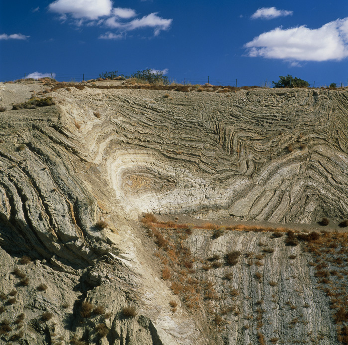
SJ3885 San Andreas fault. Folded rock strata exposed in a roadside cliff cutting through the San Andreas fault. © Science Source
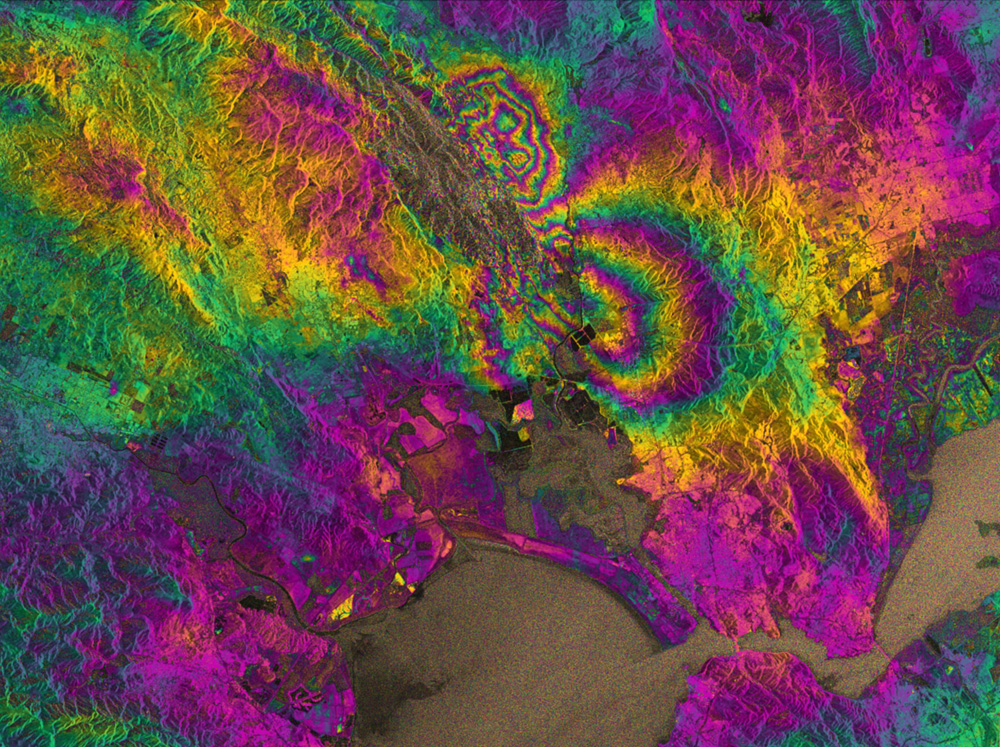
JB2116 - California's Napa Valley suffered the biggest earthquake in 25 years in the early hours of August 24, 2014. By processing two Sentinel-1A images, which were acquired on 7 August and 31 August 2014 over the region, an interferogram was generated. The two round shapes around Napa valley, which are visible in the central part of the image show how the ground moved during the quake. Deformation on the ground causes phase changes in radar signals that appear as the rainbow-coloured patterns. Interferograms like these are being used by scientists on the ground to help them map the surface rupture and model the earthquake. This interferogram very clearly shows the fault that caused the earthquake, which had not been identified as being particularly hazardous prior to the event.
Images © Science Source
BW7388 Peru Earthquake May 31, 1970. Slumping and fissuring of the paved road near the bay shore in western Chimbote due to liquefaction and lateral spreading of water-saturated beach sediments. © Science Source
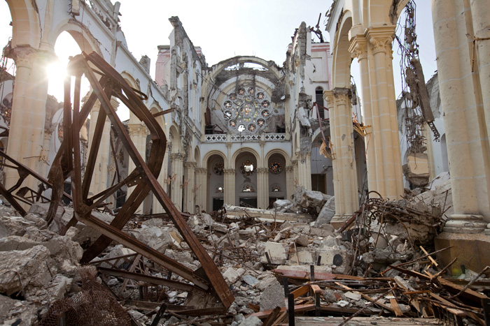
BP5253 Earthquake damage to the cathedral in downtown Port-au-Prince, Haiti. The damage is from the 7.0 earthquake that hit on January 12, 2010. © Science Source
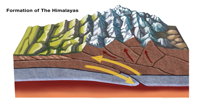
BX7462 The Himalayas started forming about 70 million years ago as a result of tectonic plate activity: the north-moving Indo-Australian Plate collided with the Eurasian Plate. In this diagram, the leading edge of the Indian plate subducts beneath the Eurasian. © Science Source
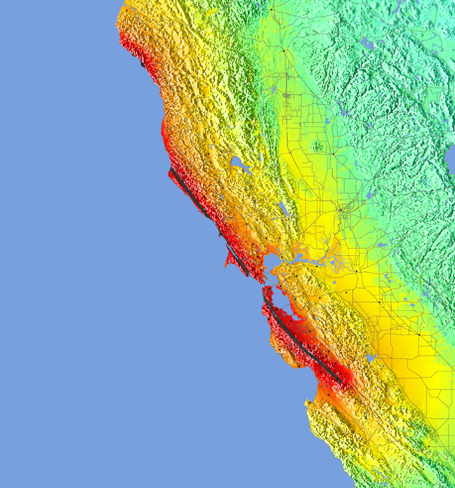
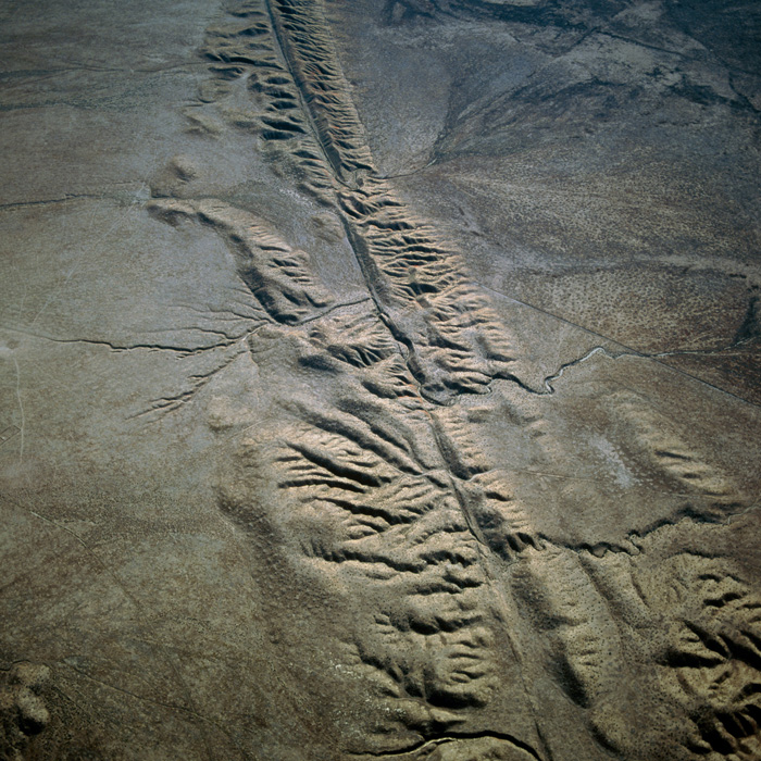
SC5313 San Andreas fault. Aerial photograph of the San Andreas fault crossing the Carrizo Plain of California, USA. © Science Source
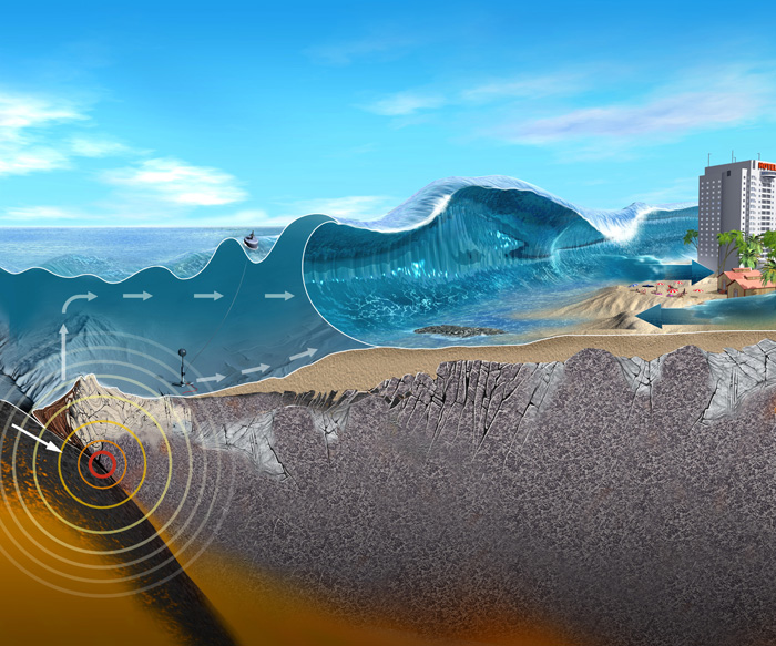
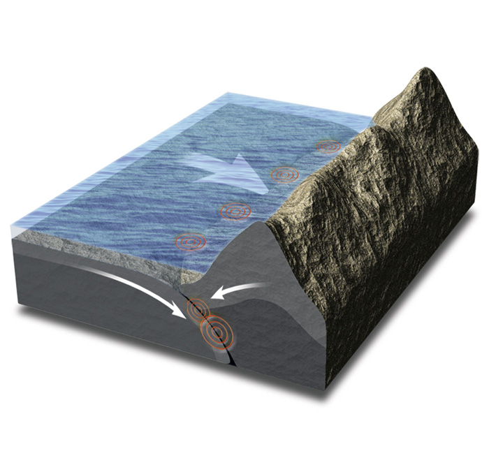
SP7289 Underwater earthquake and tsunami. Cutaway artwork showing how an underwater earthquake (left) can trigger a tsunami and devastate coastal areas (right). © Science Source
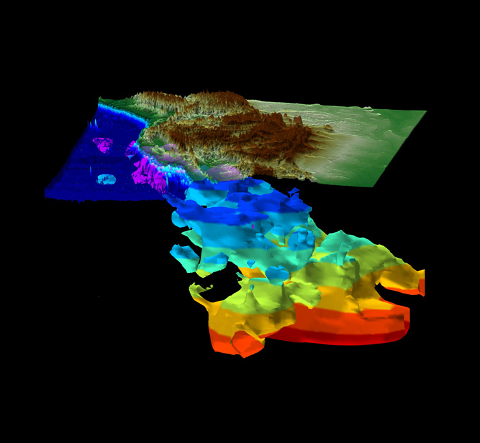
SP0761 Farallon plate. 3-D computer model of a seismically active slab of the Earth's mantle under western North America known as the Farallon plate. © Science Source
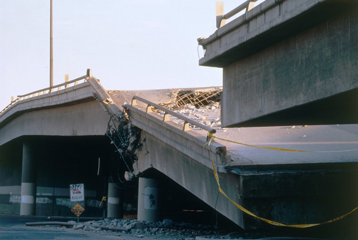
3G9836 Earthquake damage to an overpass in Los Angeles, California. © Science Source
SQ6640 Earthquake types. Artwork showing tectonic plate movements (arrows) and associated earthquakes (red concentric rings). Tectonic plates moving parallel to each other (left) lead to strike-slip earthquakes. © Science Source
3Q9120 Chasm along fault scarp showing minor vertical displacement. Lavic Lake Fault, Hector Mine. 7.1 M Earthquake in San Bernardino County, California. © Science Source
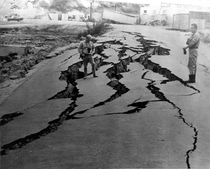
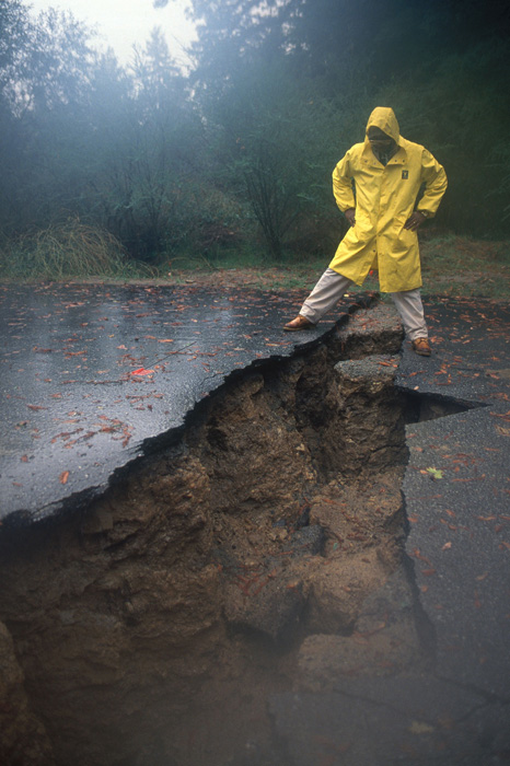
7J2074 This fissure was caused by an earthquake in October 1989. Santa Cruz, California. © Science Source
SC5331 Seismograph trace. Artwork of a printout (seismogram) from a seismograph machine. © Science Source
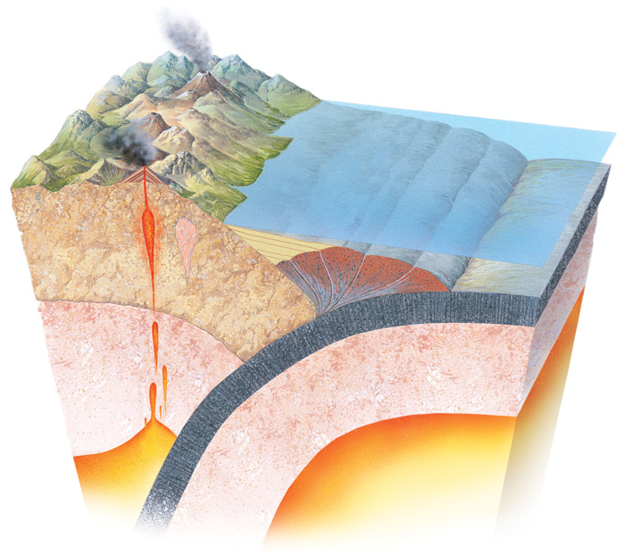
SK2648 Accretionary prism. Artwork of a cross-section through the Earth's crust showing the formation of an accretionary prism at a subduction zone. © Science Source
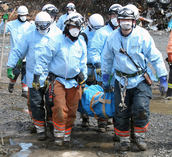
SR7730 Minami Sanriku. Rescue workers recovering a dead body in the town of Minami Sanriku, Miyagi prefecture, Japan, after the 2011 earthquake and tsunami. © Science Source
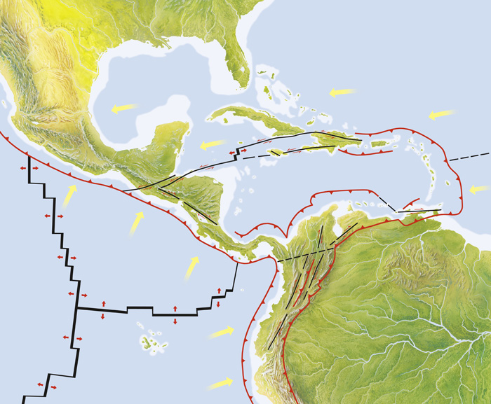
SN2024 Central America tectonic plates, diagram. The two main tectonic plates shown here are the Coscos plate (center left) and the Caribbean plate (center to center right). © Science Source
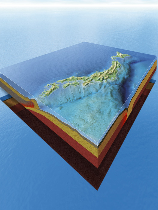
SQ2412 Japan's plate tectonics. Computer artwork showing the islands of Japan and their underlying tectonic plates. © Science Source
SR7696 Earthquake rescue team. Swiss search and rescue worker and his dog searching amongst rubble for survivors of the 1988 earthquake in Armenia. © Science Source